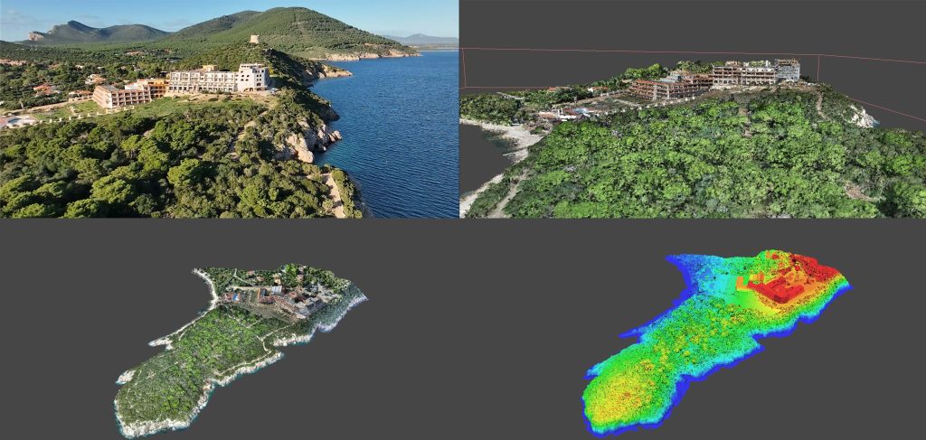
The following documents were delivered to the client: a detailed topographic survey of the external structures of the various residential complexes, a general plan of the area, a digital model of the surfaces, including the roofs, and a point cloud representing all the elevations of the buildings.
This data was provided for the subsequent restitution of the “as built” state of all the existing structures.
The vector restitution of all the elevations had a total length of approximately 650 linear meters, for a total surface area of approximately 10,000 square meters.