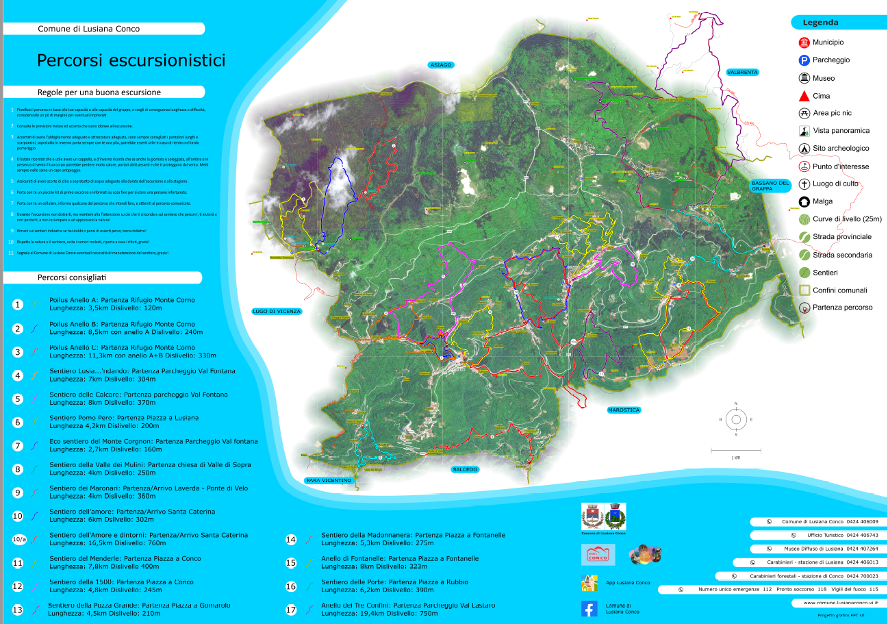
Cartographic development for the trail network of the Lusiana-Conco municipality
The project deals with the creation of detailed and informative maps. With the aim of representing a geographical area which has recently been the subject of an intervention to improve and redevelop the local path